Navionics+ Large UK & Ireland Chart NAEU628L
This product will only be supplied when purchased together with an eligible chart plotter.
All-in-one max detailed cartography for marine and lakes makes Navionics+ the perfect choice for cruising, fishing and sailing. Get the most accurate navigational data for your GPS plotter, an exclusive 0.5 m HD bathymetry map which is enhanced by boaters like you, and unique local content shared by Navionics app users. Navionics make edits every day, so you can always have the most current charts.
When you purchase a new Navionics+ Chart, a 1 year subscription to daily updates and advanced features is included.
Check if your GPS plotter model is compatible with advanced features (click here) and make sure it is running the latest software. Activate your subscription online within 2 months of purchase.
Advanced Features or the download of chart updates require an active subscription. When your subscription expires after 1 year, you can purchase a Navionics Updates Chart from us. If you don’t, you can still use your chart layers.
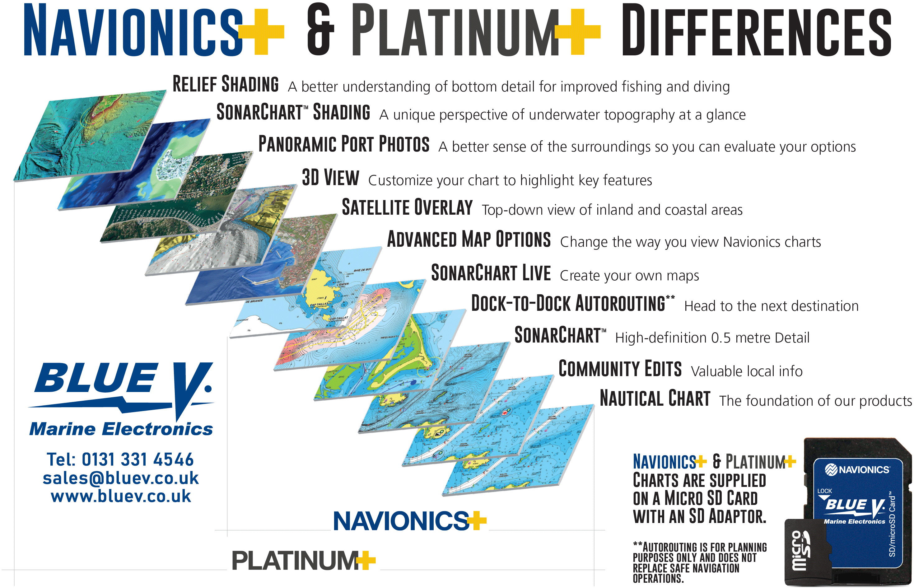
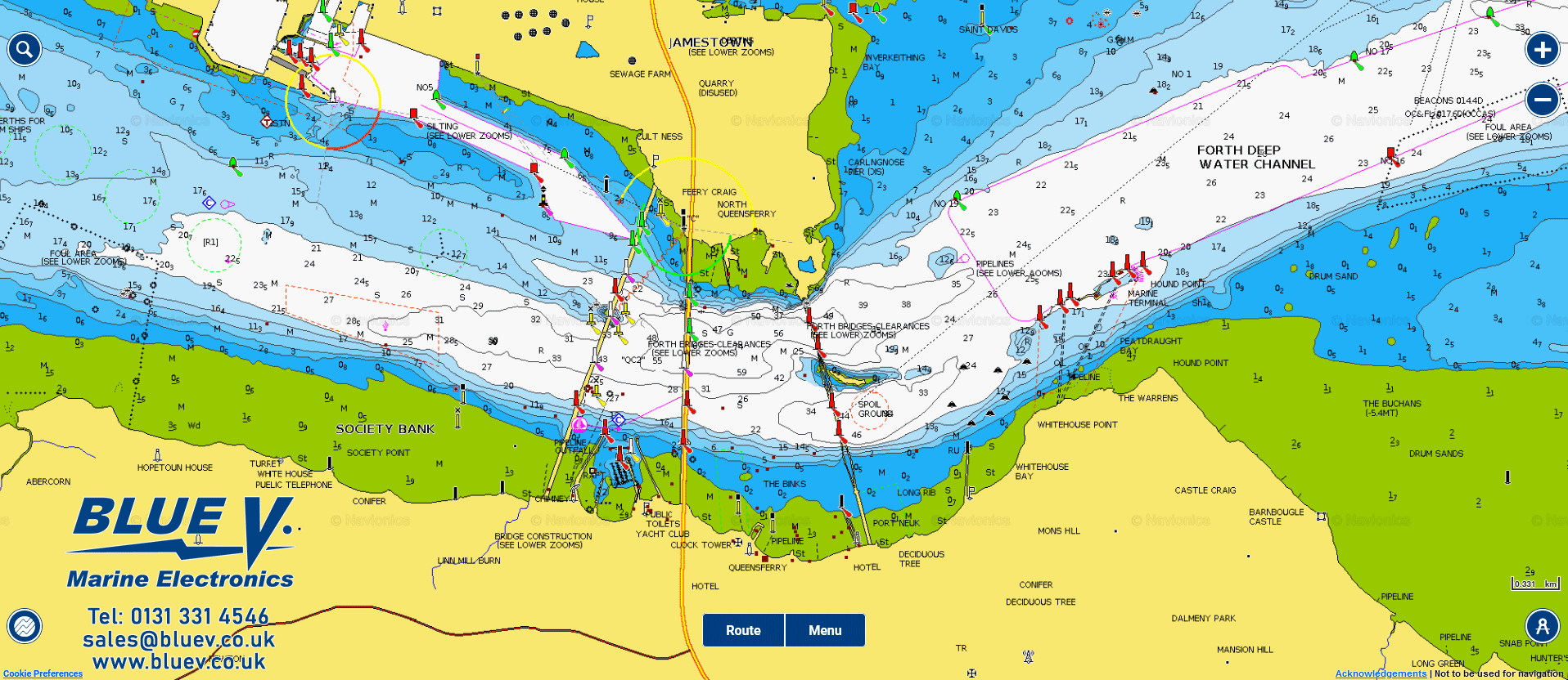
Nautical Chart – go boating with comprehensive charts derived from multiple official, government and private sources, displayed in a familiar look and feel. Use the map to study port plans and safety depth contours, identify tides & currents, and locate navigation aids, nearby marine services and more!
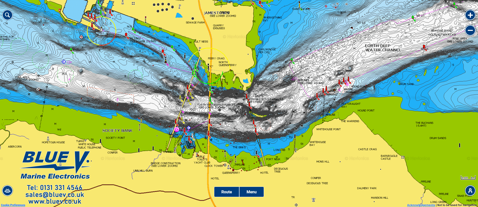
SonarChart – understand depths and bottom detail with Navionics innovative 1ft/0.5 m bathymetry charts created using Navionics proprietary systems that process sonar data contributed by boaters with existing content.
Community Edits – get useful local knowledge from fellow boaters in this crowdsourced content layer packed with points of interest, navigation aids and variety of edits made by users of our boating app.
Advanced Features
Plotter Sync – allows compatible chartplotter owners to transfer routes and markers, update chart layers and more — to and from the Boating app.
Dock to Dock Autorouting** – choose your destination by selecting a point of interest, entering a lat/long or by tapping on the map. Dock-to-dock Autorouting calculates a suggested route.
SonarChart Live – watch new 0,5 m personal HD bathymetry maps develop in real time as your boat moves along the water! It appears as an additional layer over your map, while it also gets stored on your device for future use.
Advanced Map Options – change the way you view Navionics charts and focus on the details that matter most to you.
- Highlight shallow areas: Whether you want to target shallow areas for sight fishing or avoid damaging your prop, recognize them at a glance by shading up to your preferred depth.
- Adjust contour density: Sometimes less is more. Very steep drop-offs can result in overlapping contour lines. Now you can see more clearly by lowering the density level for SonarChart.
- Select a fishing range: When you know the fish are suspended over certain depths, highlight the range so you can quickly identify more places to check out.
Plotter Sync - Plotter Sync allows compatible chartplotter owners to transfer routes and markers, update chart layers and more to and from the Boating app.
- What You Can Do: Without removing the card from your chartplotter:
- ACTIVATE: From your boat, you can activate Navionics+ Large, Platinum+ plotter cards to enable daily chart updates and advanced features.
- TRANSFER ROUTES AND MARKERS: Easily transfer routes and markers between your mobile app and plotter card, a great time-saver! An active app subscription is required.
- UPDATE CHART LAYERS: Update chart layers on your plotter card to get the most current data via Plotter Sync. An active app subscription is required.


